
In the vibrant world of agriculture, innovation often plays a pivotal role in transforming traditional farming practices into more effective and efficient systems. One of the groundbreaking advancements that have captured the attention of farmers across the USA is drone agriculture mapping. This technology, which leverages the prowess of aerial imagery and data analysis, has proven to be a game-changer for farmers looking to maximize their productivity while minimizing costs.
What is Drone Agriculture Mapping?
Drone agriculture mapping involves the utilization of Unmanned Aerial Vehicles (UAVs), commonly known as drones, to gather high-resolution imagery and data to inform agricultural practices. These drones are outfitted with sophisticated sensors that allow them to capture detailed information about the health of crops, soil conditions, and even irrigation patterns. At Aeroyantra Technologies Private Limited we provide the services that enable farmers to effectively use this technology to improve their crop yields.
Benefits of Drone Agriculture Mapping for Farmers
1. Enhanced Crop Monitoring
One of the most significant advantages of drone agriculture mapping is its ability to monitor large areas of farmland quickly and efficiently. Traditional methods of crop inspection are time-consuming and often require physical access to fields, which may not always be feasible. Drones eliminate these limitations by providing a bird’s-eye view of the entire farm, enabling farmers to quickly identify areas that require attention and preventing potential crop losses.
2. Precision Agriculture
Precision agriculture aims to optimize field-level management regarding crop farming. Drone technology complements this approach by providing data that can be used to make informed decisions. Farmers can analyze crop health, moisture levels, and nutrient deficiencies at a granular level, allowing them to apply inputs only where needed. This targeted approach results in higher productivity and reduced wastage of resources.
3. Efficient Irrigation Management
Water management is crucial in farming, particularly in regions prone to drought. Drones equipped with thermal imaging cameras can assess soil moisture levels across the farm. By identifying dry patches and areas that may need additional irrigation, farmers can manage their water usage more effectively. This not only conserves a precious resource but also supports healthier crop growth.
4. Crop Health Assessment
Using multispectral imaging technology, drones can detect plant stress much earlier than is possible to observe with the naked eye. This technology can indicate nutrient deficiencies or diseases in crops before symptoms appear, allowing farmers to take proactive measures. Early intervention can lead to significant improvements in yield, allowing farmers to maximize productivity.
5. Mapping and Planning
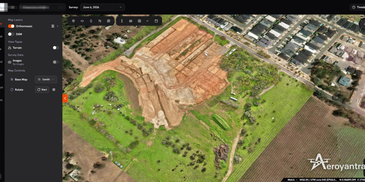
Drones are also invaluable for creating detailed maps of farmland. These maps can aid in planning planting patterns and crop rotations, and can assist in land management decisions. With precise mapping, farmers can better understand their fields, leading to optimized planting strategies and improved overall productivity.
6. Cost Efficiency
While some may view investing in drone technology as a significant upfront cost, the reality is that the long-term savings can be substantial. By reducing the labor required for monitoring, minimizing losses through early detection, and optimizing resource use, farmers can see a solid return on investment. The data gained from drone agriculture mapping directly correlates with better decision-making, ultimately leading to enhanced profitability.
How Aeroyantra Technologies Can Help
At Aeroyantra Technologies Private Limited, we understand the challenges that farmers face. Our solutions are designed to optimize agricultural practices by enabling the effective use of drone technology. We provide expertise in data analysis, interpretation, and actionable insights, allowing farmers to harness the full potential of drone agriculture mapping.
We’re committed to assisting farmers as they navigate this landscape of technological advancement, ensuring they have access to the knowledge and tools necessary for success. Our goal is to contribute to a more sustainable and productive future for agriculture in the USA.
FAQs about Drone Agriculture Mapping
Q1: What drone specifications are ideal for agriculture mapping?
A: While we do not manufacture drones, ideal drones for agriculture mapping typically include high-resolution cameras, GPS capabilities, and various sensor types to capture data accurately.
Q2: Is there a significant learning curve for using drone technology in agriculture?
A: Initially, there may be a learning curve; however, many agricultural drone companies provide training and resources to help farmers quickly adapt to this technology.
Q3: How often should I perform drone mapping over my fields?
A: The frequency of drone mapping depends on various factors like crop type, growth stage, and weather conditions. Generally, regular assessments during critical growth periods can be beneficial.
Q4: Can drone agriculture mapping be used for all types of crops?
A: Yes, drone agriculture mapping can be utilized for a wide variety of crops, helping farmers regardless of the type they cultivate.
Q5: What kind of data can I expect from drone mapping?
A: Data collected through drone mapping can include crop health indices, soil moisture levels, and detailed topographic maps, all of which contribute to more informed decision-making.
Q6: Are there regulations for using drones in agricultural settings?
A: Yes, it’s essential to follow local regulations regarding drone operations, which may include obtaining a remote pilot certificate and adhering to guidelines set by the Federal Aviation Administration (FAA).
Conclusion
In a rapidly evolving agricultural landscape, drone agriculture mapping stands out as a powerful tool for farmers aiming to maximize productivity and ensure sustainability. By adopting this innovative technology, farmers can enhance their monitoring, optimize resource use, and ultimately drive profitability. At Aeroyantra Technologies Private Limited, we are proud to support the agricultural community by offering services and insights that empower farmers to thrive in this dynamic environment. Whether through improved crop health assessments or efficient irrigation management, our commitment remains to help farmers harness the potential of drone technology for a more productive future.
For more information, contact us at +1 (346) 486-4931. Let’s explore how we can help you transform your farming practices with drone agriculture mapping!